
Seefin [Sui Finn]
Good walks are even better shared.
Overview
Seefin [Sui Finn]
Introduction
Nestled within the stunning Wicklow Mountains, Seefin, or Sui Finn, calls out to hikers eager to explore its rocky terrains and natural beauty. With an elevation of 603 meters, it might not be the tallest peak, but trust us, it doesn’t skimp on stunning vistas.
Geology
Seefin boasts fascinating geological features typical of the area. Its primary composition of granite and schist tells a tale of ancient processes that shaped this rugged landscape. Glacial activities have left their mark, presenting a captivating mix of ridges, valleys, and pockets of heather.
Routes
Two popular routes lead to the summit:
- Powerscourt Waterfall Trail: This route is simply delightful, leading you past Ireland’s highest waterfall. It stretches over 8 km and takes approximately 3.5 hours to conquer at a moderate pace.
- Glendalough to Seefin: For those who crave a challenge, this 12.5 km trek connects Glendalough with Seefin and requires around 5 hours. Consider packing an extra snack for this one!
Summit Features
Upon reaching the top, hikers are greeted by a friendly cairn and a triangulation pillar. What better spot to take a breather and snap a few pictures? The views make it worth every step.
Terrain Type
Expect a rocky adventure with a mix of grassy patches and heather blooms. Be prepared for the occasional boggy patch—your waterproof boots will thank you later!
Scenic Views
You’ll be treated to fabulous panoramas. Look out for the iconic Glendalough Valley and further afield, the Irish Sea can be glimpsed on crystal clear days. Autumn showcases a delightful tapestry of colours, while summer brings in the clear skies and endless vistas.
Hazards
Always be on guard for the unpredictable Irish weather, and remember, those rocky paths can be a bit slippery when wet. Stick to marked trails to avoid any hiccups on your hike!
Access and Facilities
Nearest parking can be found at Powerscourt Estate. Public transport options are limited, so a car might be your best bet, especially on weekends. Grab a coffee in Enniskerry before you set off—it’s the perfect start to an adventure!
Conclusion
Seefin is an excellent choice for both fledgling trekkers and seasoned hikers alike. Whether you decide to tackle it on a brisk morning or a serene autumn afternoon, be prepared to fall in love with the landscape. So lace up your boots, pack your essentials, and set out to enjoy the wonders of Seefin. You won’t be disappointed!
Remember to check the weather and enjoy your hike!
Explore routes near Seefin [Sui Finn]
Walks starting near this hill. Open a route to check its map, distance and full itinerary.
Route planning notes
These notes describe possible approaches. Check a route's map and access information when planning your walk.
Powerscourt Waterfall Trail
A scenic route beginning at Powerscourt Waterfall, offering breathtaking views of the surrounding countryside and a gradual ascent towards the summit.
Glendalough to Seefin
A longer trek connecting Glendalough to the summit of Seefin, this route is a popular choice with hikers looking for an adventure.
Make a day of it, together
Find someone to share the walk with, or organise a day out along a route you like.
Hill facts and local notes
Classifications
Elevation
621m
2,036 ft
Prominence
22m
Coordinates
53.1862, -6.3942
O073162
OS Map
56
At the Summit
The summit features a modest cairn and a triangulation pillar, offering a great photo opportunity. It’s a perfect spot to catch your breath and reflect on your journey.
Terrain & Geology
Primarily composed of granite and schist, Seefin's geology reflects the rugged, ancient formations typical of the Wicklow Mountains. The area is rich in glacial features and showcases stunning geological formations.
Views & Scenery
From the summit, you'll enjoy sweeping views of the Wicklow Mountains, the glacial valleys of Glendalough, and on a clear day, you might even catch a glimpse of the Irish Sea.
History & Heritage
Name Origin
The name 'Seefin' is derived from the Irish 'Siuifín', which translates to 'little, pleasant hill'.
Historical Significance
Seefin is a popular destination for both casual walkers and enthusiastic hikers, contributing to the local tourism and outdoor culture.
Getting There & Facilities
Parking
Parking is available at the entrance to Powerscourt Estate, with ample spaces but can fill up quickly during weekends.
Public Transport
Limited public transport is available; it's advisable to check local bus timetables that run from Dublin to Enniskerry.
Nearby Facilities
There are toilets available at Powerscourt Estate and various cafes in Enniskerry for a pre-hike snack.
Safety Information
Known Hazards
- Be wary of sudden weather changes. The terrain can be slippery, especially in wet conditions. Always stay on marked paths to avoid getting lost.
General Safety Tips
- Check weather conditions before setting out
- Carry appropriate clothing and equipment
- Let someone know your planned route
- Take a map, compass, and GPS device
- Carry emergency supplies: food, water, first aid kit, torch
Hills
Some common questions about the hills answered
Are there group walks up Seefin [Sui Finn]?
Many walkers use Walkmates to join or organise walks with others. You can check for group walks around Seefin [Sui Finn] through the maps
Are there other walkers around Seefin [Sui Finn]?
Activity varies by location and time, but Walkmates lets you see whether others have shared walks or shown interest in this area. Find other people through the walking friends search walking friends for Seefin [Sui Finn] search or of course create your own walk for Seefin [Sui Finn]
Can I organise a walk to Seefin [Sui Finn]?
Yes. If there aren’t any walks listed already, you can create a walk and make it available for others to join.
If you're signed up to Walkmates, you can create a walk to Seefin [Sui Finn].
How do I find a walk up this hill?
There are often multiple ways to walk this hill, depending on experience and route preference. Walkmates helps you explore walks and routes that others have shared.
Can I suggest a new route up Seefin [Sui Finn]?
Yes. You can suggest or create routes to share with others. Walkmates focuses on the social side of walking, so routes are used to help people organise walks and explore areas together, rather than as detailed navigation tools or route libraries.
Other uses really appreciate knowledgeable walkers sharing their routes. Share your favourite route to Seefin [Sui Finn] here
The is an error or something incorrect about this hill. How do I let you know?
We always strive to keep the information on Walkmates as accurate as possible. If you find an error, please let us know through the contact form and we'll aim to correct it as quickly as possible
Community Discussion
Comments
Location
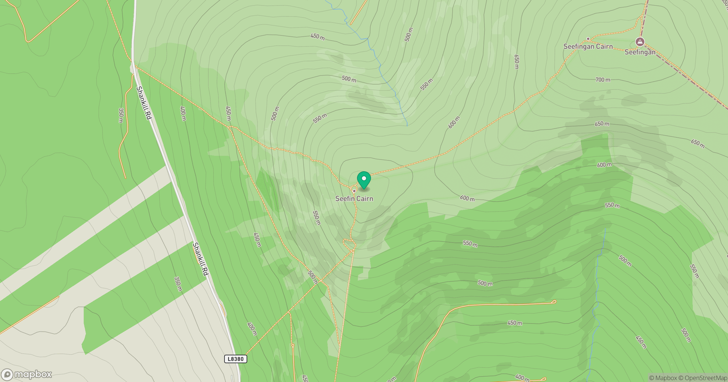
Grid reference: O073162
View on OpenStreetMapOpens a map in a new tab, centred on the hill.
Nearby Hills
Mullaghcleevaun
847m
Lugnaquilla [Log na Coille]
925m
Slieve Foye
587m
Slieve Gullion
576m
Slieve Binnian
746m
No comments yet. Be the first.